
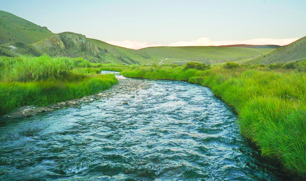
Wetlands and water - you saw them then, now you don’t


SAN LUIS VALLEY - Peggy Godfrey, Saguache County representative to the Rio Grande Water Conservation District (RGWCD) board, has been looking for water – more specifically the water she believes has been displaced from lower Saguache Creek and San Luis Creek into the Rio Grande Closed Basin Project.
Prompted by board members requesting a work session at the September meeting, and in receipt of letters including a letter from the Saguache County Commissioners, the RGWCD board met Jan. 16 in public session to review the research prepared by Godfrey.
Godfrey, with the support of the Saguache County Commissioners, is requesting an independent engineering study of the impact from Stages 4 and 5 of the Closed Basin Project in an attempt to address adverse impact on the watersheds of lower Saguache Creek and San Luis Creek.
Godfrey’s research reveals language in the original act that gave authorization to the Closed Basin Project (CBP), language that included assurances that the project would not injure senior water rights. Additionally the 1967 engineering report reinforced this point with language stressing “a balance of inflow and outflow” of water…and contained a warning that “If priority (of water rights) is not strictly enforced the CBP would become a mining project.”
In 1972 the Rio Grande Water Conservation District filed for water rights on the “salvage,” unconfined groundwater water within the closed basin. The water is “pumped” from the salvage wells into a 42-mile conveyance channel that delivers the water to the Rio Grande.
According the RGWCD website: “The purpose and first priority of the Closed Basin Project is to deliver water to the Rio Grande to assist the State of Colorado in meeting its delivery requirements under the Rio Grande Compact of 1939 and the Rio Grande Convention of 1906. “The second priority of the project is to maintain the Alamosa National Wildlife Refuge (NWR), provided that the amount of project salvaged water delivered to the NWR and The Blanca Wildlife Habitat Area (WHA) shall not exceed 5,300 acre-feet annually.
“The third priority is to apply to the reduction and the elimination of any accumulated deficit in deliveries by Colorado and is no longer applicable since the spill of Elephant Butte in 1985. The fourth and final priority is for irrigation or other beneficial uses in Colorado.
“The project also delivers mitigation water to San Luis Lake complex and its recreational facilities.”
Godfrey’s argument for an independent study is to evaluate the effects of continuing to pump salvage wells in Stages 4 and 5 (at the north end of the project) is based on 1) changes from flood irrigation to center pivot irrigation, 2) the data in the previous studies done in the 1960s and 1980s is outdated and perhaps flawed and 3) that intentional or not, there is evidence that injury is being done to senior water rights in the watersheds of lower Saguache Creek and San Luis Creek.
A variety of experts hastened to point to Godfrey that under the Congressional Act, there was to be no injury and that the district was allowed to pump until there was a two-foot drop in the water levels to wells located on or near the boundary. Keep in mind that the east side of phase 4 is in a historically wet area from creeks flowing from the Sangre de Cristo mountains into the Baca National Wildlife Refuge, comprising the earliest of surface water rights purchased along with the ranch by the Department of the Interior.
Salvaged water is defined as water otherwise unavailable for beneficial use that is saved by some means and made available. In 2004 Congress created the Baca National Wildlife Refuge as part of the legislation that also created the Great Sand Dunes National Park. In addition to groundwater recharge, under Colorado water law wildlife habitat (including fisheries) is considered a beneficial use.
Arguments from other district board members, previous managers and legal counsel, asserted that while the Closed Basin Project was initiated as a salvage project, it is not just about salvage. Established by Congress it was created for salvaging, regulating, and furnishing water from the Closed Basin area.
Salvage is a key term here. Under state water law and groundwater rules, the water from salvage wells is exempt from state regulation. Unlike the rules governing the more recently created sub-districts through the valley, the RGWCD does not have a water right to replenish groundwater pumped, nor is it required to.
Godfrey maintains the intent of the various documents establishing the Closed Basin Project prohibits “mining” water. The argument is based in the spirit of the language that continually asserts “no injury” to existing senior water rights holders.
Groundwater mining is the removal, or withdrawal, of water in the natural ground over a period of time that exceeds the recharge rate of the supply aquifer. She and her neighbors assert that the continuous pumping over the past three decades has created depletion of water under 130,000 acres by redirecting recharge from natural processes into well fields within the Closed Basin Project.
There are many factors at play that support the request to re-evaluate and study the data that has been collected from the monitoring wells over the past few decades. The hydrologic cycle teaches the continuous movement of water on, above and below the surface of the Earth. Water is always in movement.
Today in the midst of debates about climate change, along with changes in precipitation over the years, it is not too much to ask that decisions made 50 years ago be re-visited. Water is always changing states between liquid, vapor and ice, with these processes happening in the blink of an eye and over millions of years.
At the RGWCD meeting Jan. 21, the board members voted to instruct the manager of the district to make some inquiries with hydrologists and explore the possible costs of reviewing the data already collected for Stages 4 and 5.
A follow-up meeting is set for Feb. 24, 1 p.m. at the RGWCD offices, 8805 Independence Way in Alamosa. Eric Harmon, a hydrologist with lengthy valley experience, has been invited to speak about the hydrology of the north valley and to a study of the concerns of a number of residents about the CBP possible effects on Saguache Creek and San Luis Creek.
Lisa Cyriacks is a freelance writer.